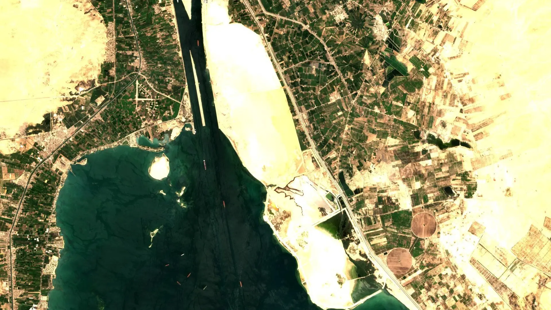
A small number of narrow waterways carry a large share of world trade [1]. When traffic through the Suez Canal slows, cargo is delayed, freight rates move and insurers reassess their exposure [1]. Satellite imagery lets trade finance teams, freight analysts and marine underwriters see this directly. The scene above shows the canal where it opens into the Great Bitter Lake.
Traffic through the canal
On a clear day, ships along the canal and at anchor in the lake can be picked out as small marks on the water. Counting them across repeat passes gives a view of how busy the route is, and whether a queue is forming at either end. Higher-resolution imagery at 30 cm goes further, making vessel type, size and loading easier to judge.
Queues and anchorages
Ships waiting to enter a canal or port gather in anchorages. Imagery shows how many are waiting and how long the queue has stood. For trade finance, a growing queue is an early sign that goods linked to a letter of credit may arrive late. For marine insurers, it shows how many vessels are concentrated in one place at one time.
Radar sees through cloud
Optical imagery needs daylight and a clear sky. Sentinel-1 is a radar satellite that sees through cloud, by day and by night [2], and ships show up on it as bright points against dark water [3][4]. Radar can detect that a vessel is present but says little about what it is carrying. Many teams therefore use radar for regular coverage of a chokepoint and call on sharper optical imagery to look closely at a particular vessel or anchorage.
Open and commercial together
Copernicus Sentinel-1 and Sentinel-2 data is free to use [5] and is included on Data Sphere, next to commercial optical imagery from suppliers such as Orbview and Vantor. Both can be found in a single search.
The imagery for this work can be searched across suppliers on Data Sphere. To see it for a site you follow, write to info@astrodynamic.space.
References
- Delivorias, A. Recent threats in the Red Sea: Economic impact on the region and on the EU. European Parliamentary Research Service, PE 760.390, March 2024. https://www.europarl.europa.eu/RegData/etudes/BRIE/2024/760390/EPRS_BRI%282024%29760390_EN.pdf
- European Space Agency. Emergency response. ESA. https://www.esa.int/Applications/Observing_the_Earth/Copernicus/Sentinel-1/Emergency_response
- Grover, A., Kumar, S. and Kumar, A. Ship detection using Sentinel-1 SAR data. ISPRS Annals of the Photogrammetry, Remote Sensing and Spatial Information Sciences, IV-5, 317, 2018. https://doi.org/10.5194/isprs-annals-IV-5-317-2018
- European Space Agency. Introducing the Sentinel-1 mission. ESA. https://www.esa.int/Applications/Observing_the_Earth/Copernicus/Sentinel-1/Introducing_Sentinel-1
- European Space Agency. Free access to Copernicus Sentinel satellite data. ESA, 2013. https://www.esa.int/Applications/Observing_the_Earth/Copernicus/Free_access_to_Copernicus_Sentinel_satellite_data