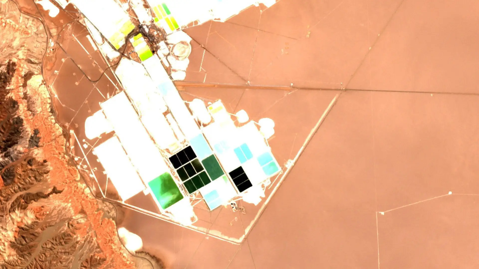
Most mines and brine fields are remote, large and slow to report. Satellite imagery gives commodity traders, analysts, lenders and insurers of mining assets a view of the same sites that does not depend on a company statement or a site visit.
Lithium brine ponds
Brine is pumped into a series of ponds and left to evaporate, and the concentration of the brine rises from one pond to the next [1]. Open Sentinel-2 imagery, free under the Copernicus programme [2], is enough to see which ponds are in use, where new ponds have been built and how the footprint of an operation changes from season to season [3]. Sharper commercial imagery shows pond edges, pumps and roads in more detail.
Open-pit gold
At the Super Pit in Kalgoorlie, Western Australia [4], repeat imagery can show the pit widening and deepening, waste dumps growing and tailings dams filling [5]. A lender can compare these changes with the development plan. An insurer can check that the site looks as the schedule says it should after a flood, a fire or a dam concern.
Iron ore stockpiles
In the Pilbara [6], iron ore sits in stockpiles at mines and at port. Stereo imagery, which captures a site from two angles, makes it possible to estimate the height of a pile and from that its volume [7]. Tracking those piles over weeks gives an independent signal on whether production is being drawn down or building up, and a trader can set it against reported output.
Choosing the imagery
Open data suits regular, wide-area checks. Very-high-resolution imagery at 30 cm suits close inspection of a single pit, pond or pile. Data Sphere puts commercial and open data in the same search, so one query covers both kinds.
References
- Torres, D., Pérez, K., Galleguillos Madrid, F., Leiva, W. and others. Salar de Atacama Lithium and Potassium Productive Process. Metals, 14(10), 1095, 2024. https://doi.org/10.3390/met14101095
- European Space Agency. Free access to Copernicus Sentinel satellite data. ESA, 2013. https://www.esa.int/Applications/Observing_the_Earth/Copernicus/Free_access_to_Copernicus_Sentinel_satellite_data
- Copernicus Programme. Diverse landscape of the Atacama desert captured by Sentinel-2. European Union, 2016. https://www.copernicus.eu/en/diverse-landscape-atacama-desert-captured-sentinel-2
- Northern Star Resources. KCGM Operations. Northern Star Resources Ltd (operator’s own page). https://www.nsrltd.com/our-assets/kcgm-operations/
- Li, Z., Zhao, Y., Ren, H., He, T. and Sun, Y. A Novel Approach to Automatically Identify Open-Pit Coal Mining Dynamics Based on Temporal Satellite Images. Remote Sensing, 17(6), 1029, 2025. https://doi.org/10.3390/rs17061029
- Rio Tinto. Western Australia iron ore operations. Rio Tinto (operator’s own page). https://www.riotinto.com/en/operations/australia/iron-ore-western-australia
- Marí, R., de Franchis, C., Meinhardt-Llopis, E. and Facciolo, G. Automatic Stockpile Volume Monitoring Using Multi-View Stereo from SkySat Imagery. 2021 IEEE International Geoscience and Remote Sensing Symposium (IGARSS), 2021. https://doi.org/10.1109/IGARSS47720.2021.9554482