
Find Viridien’s article here
Satellite-based Earth observation is changing how we protect our oceans. Using radar and optical data, satellites can detect oil spills across vast marine areas in near real-time—day or night, in any weather. Automated systems quickly identify slicks and assess their size and spread, offering critical insights to operators, regulators, and environmental teams.
A recent example involved a leaking shipwreck off the Scottish coast, where satellite monitoring revealed ongoing oil discharge threatening a protected marine zone. Viriden used data from Sentinel-1 satellites to identify oil slicks from the shipwreck, approximately 65km east of Montrose. Using their automated SeaScope system, they were able to identify a further 78 spills as far back as 2014 using archived Sentinel-1 data. Furthermore, they were able to show the shipwreck was actively leaking oil! (Between 2022-2024, shown below)
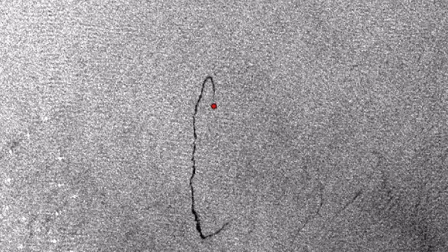
Above shows the temporal variability of oil slicks from the Montrose Bank shipwreck observed between 2022-2024, these ranged between less than 1km to approximately 8km long! (© Contains modified Copernicus Sentinel data 2023)
Early detection and active monitoring of oil spills like this can help prevent harm to local ecosystems and the wider environment. Once again, earth observation and geospatial data has been used to help prevent further harm, proving essential for modern, efficient, and responsible ocean management.