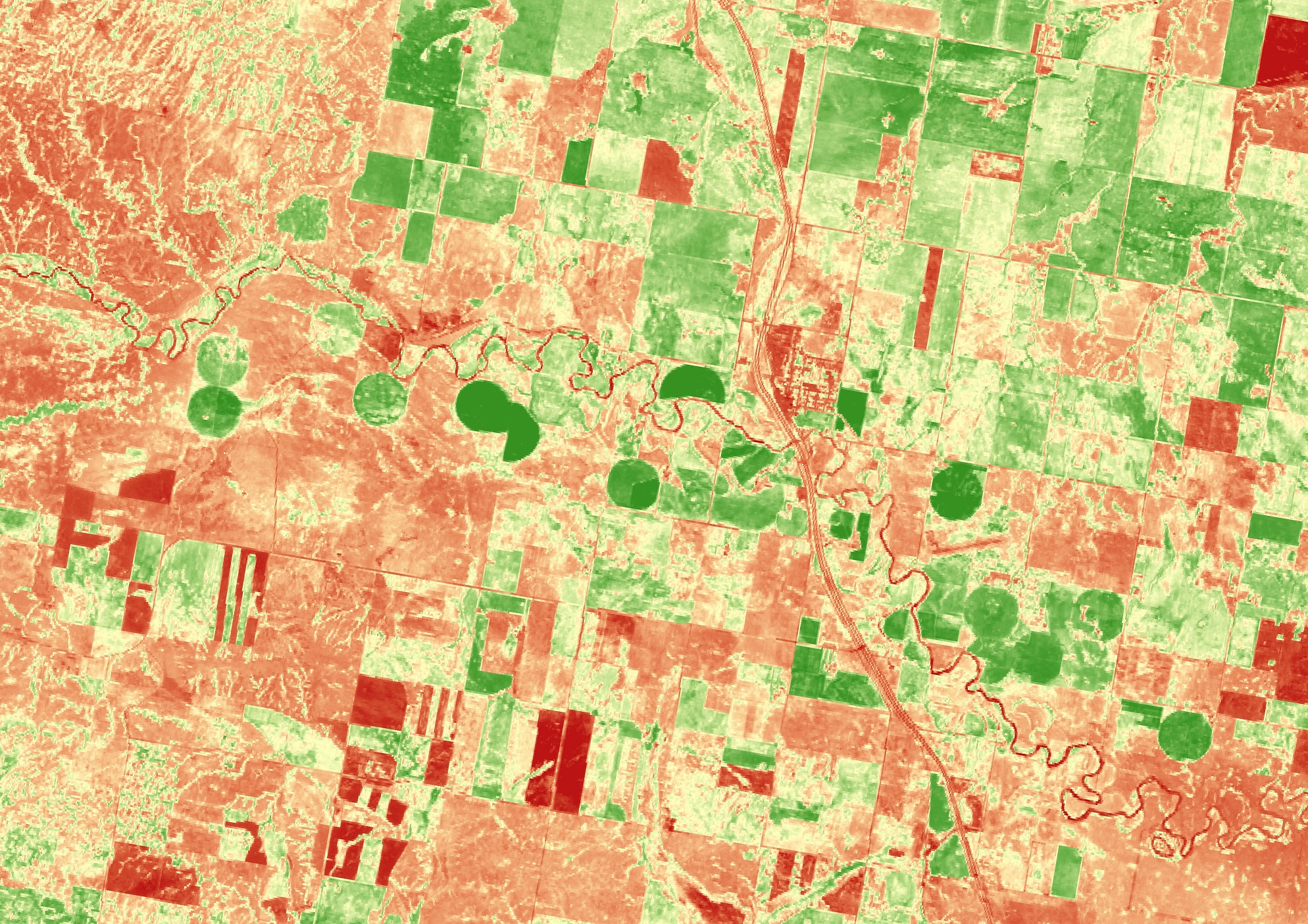
In modern agriculture, satellite-based Earth observation has become a game-changer for precision farming. High-resolution multispectral imagery from satellites such as Sentinel-2 and Landsat 8 enables farmers and agribusinesses to monitor vegetation health, soil moisture, and crop development over large areas with remarkable accuracy. For instance, Normalized Difference Vegetation Index (NDVI) maps derived from satellite data help identify stressed crops early, allowing for timely interventions such as irrigation adjustments or targeted fertilization. This data-driven approach improves yield forecasting, reduces input costs, and minimizes environmental impact.
In practice, this can have a massive impact on the management of farms. As 4EI have found in some of their case studies, using analytics derived from Earth Observation imagery helped to improve wheat farm yields by 15% from early detection and intervention of disease in crops. In another case, they found that Bean Farmers could reduce their fertilizer costs by 18%, from using Earth Observation to monitor soil nutrient levels and create fertility maps. These analytics can be integrated into farm management platforms, enabling intuitive, map-based dashboards that bring complex geospatial data into actionable insights.
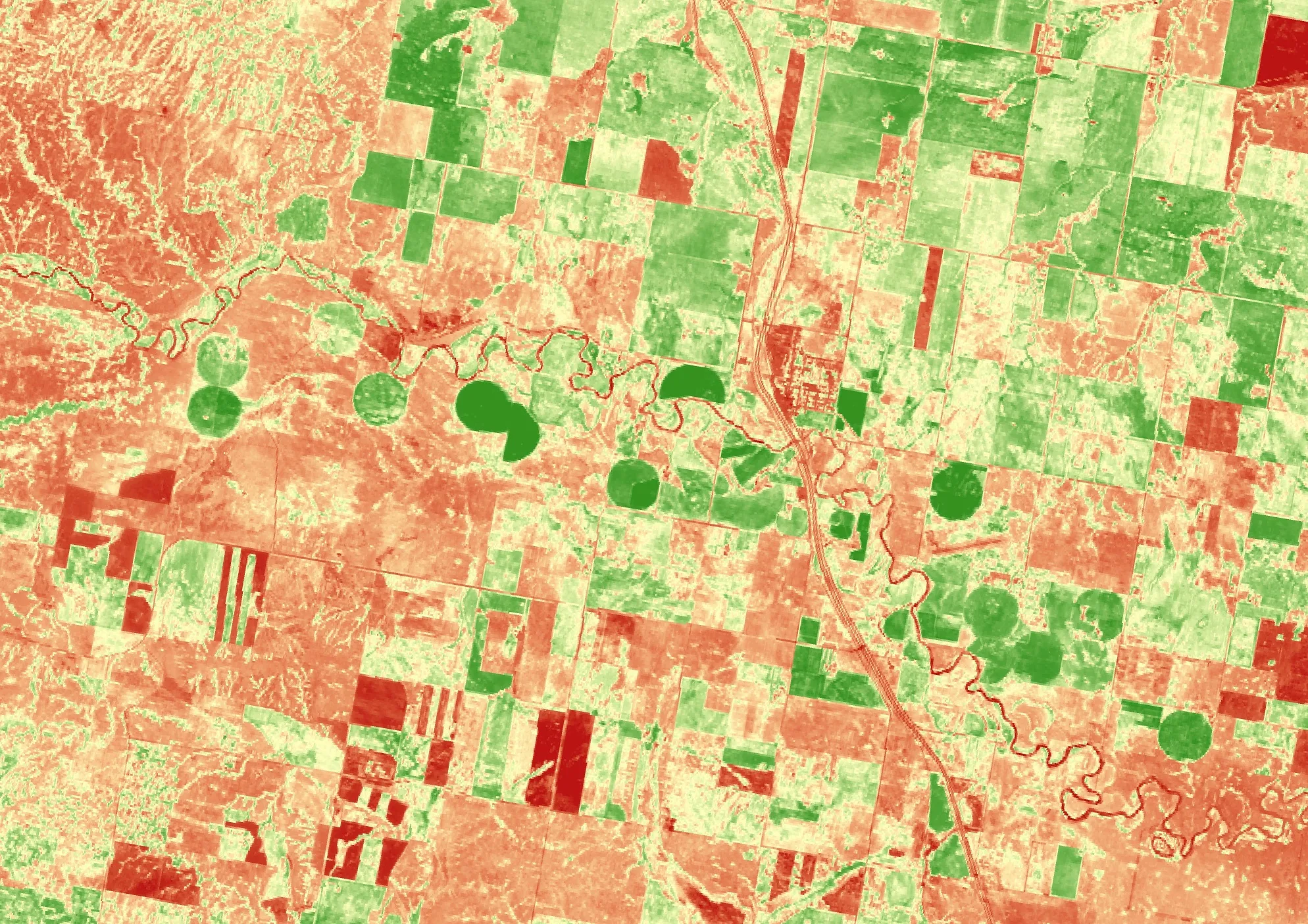
Above shows a 2016 Sentinel 2 Image, the green depicts vegetation in this normalized difference vegetation index image of land along the Milk River in Alberta. Sourced from USGS.