Satellite-based Earth observation is pivotal in the climate market, offering high-fidelity data to monitor environmental change, model climate risk, and inform policy and investment strategies. Instruments aboard satellites like NASA’s MODIS and ESA’s Sentinel-5P capture atmospheric gases, land surface temperatures, deforestation rates, and ice sheet dynamics in near real-time. Financial institutions and insurers are increasingly integrating this data into climate risk assessments, identifying exposure to physical hazards such as floods, droughts, or wildfires across portfolios. This enables accurate pricing of climate-related assets and compliance with regulatory frameworks like TCFD and EU Taxonomy.
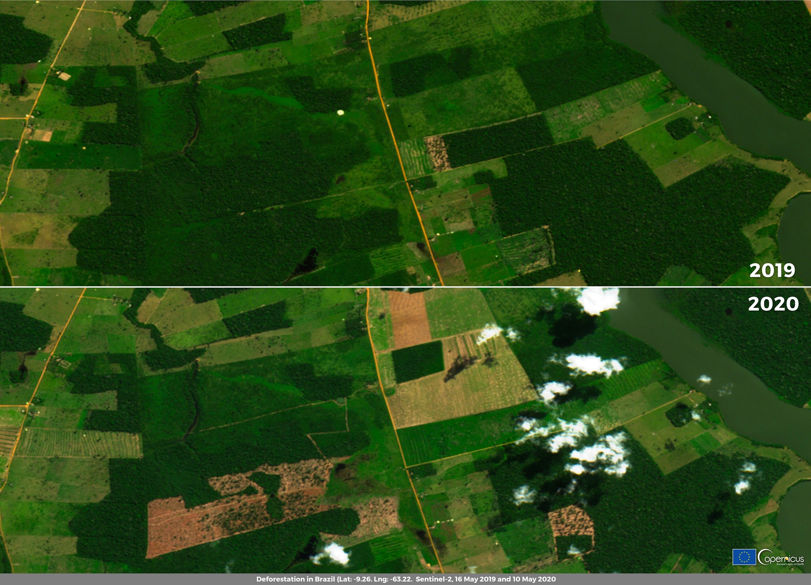
A leading use case is in deforestation tracking. In 2020, Brazil’s National Institute of Space Research (INPE) stated that between January and April 2020 that a total of 1,202 sq km of Amazon forest had been cleared, double compared to 2019 figures. This is shown by images acquired by Copernicus Sentinel 2 satellites in May 2019 and 2020 showing part of the deforestation. Using these insights, efforts can be made to mitigate deforestation across the Amazon rainforest by allocating resources in accordance with Earth Observation data.
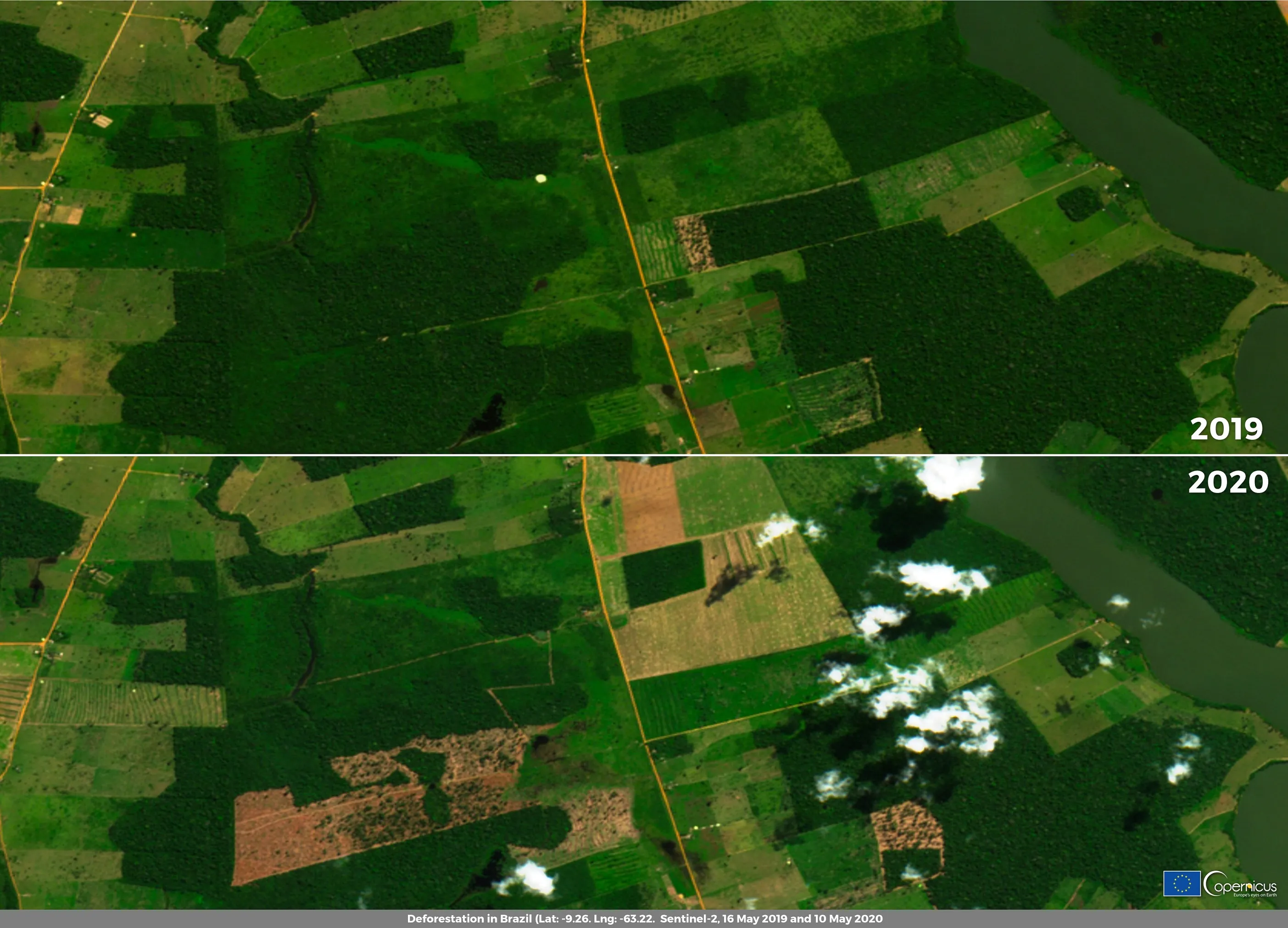
Credit: European Union, Copernicus Sentinel-2 imagery